
#DreamPOWABC A white sheet of paper with that written with a black sharpie has been taped to the inside of the door on the pantry cupboard for a couple of years. After the winter solstice, as the days lengthen, more and more on my focus – to say nothing of pleasant distractions – is on Alaska. The tiny part of Alaska that is “Southeast.” It’s the panhandle where my Dream is of circumnavigating the four great islands of Southeast Alaska. Prince of Wales (POW), Admiralty, Baranof, and Chichagof Islands (the ABCs). This year we went clear around Chichagof, leaving only Baranof, with its long and somewhat foreboding outer coast.
Wednesday 15 May Petersburg 56º48.7’N 132º57.7’W
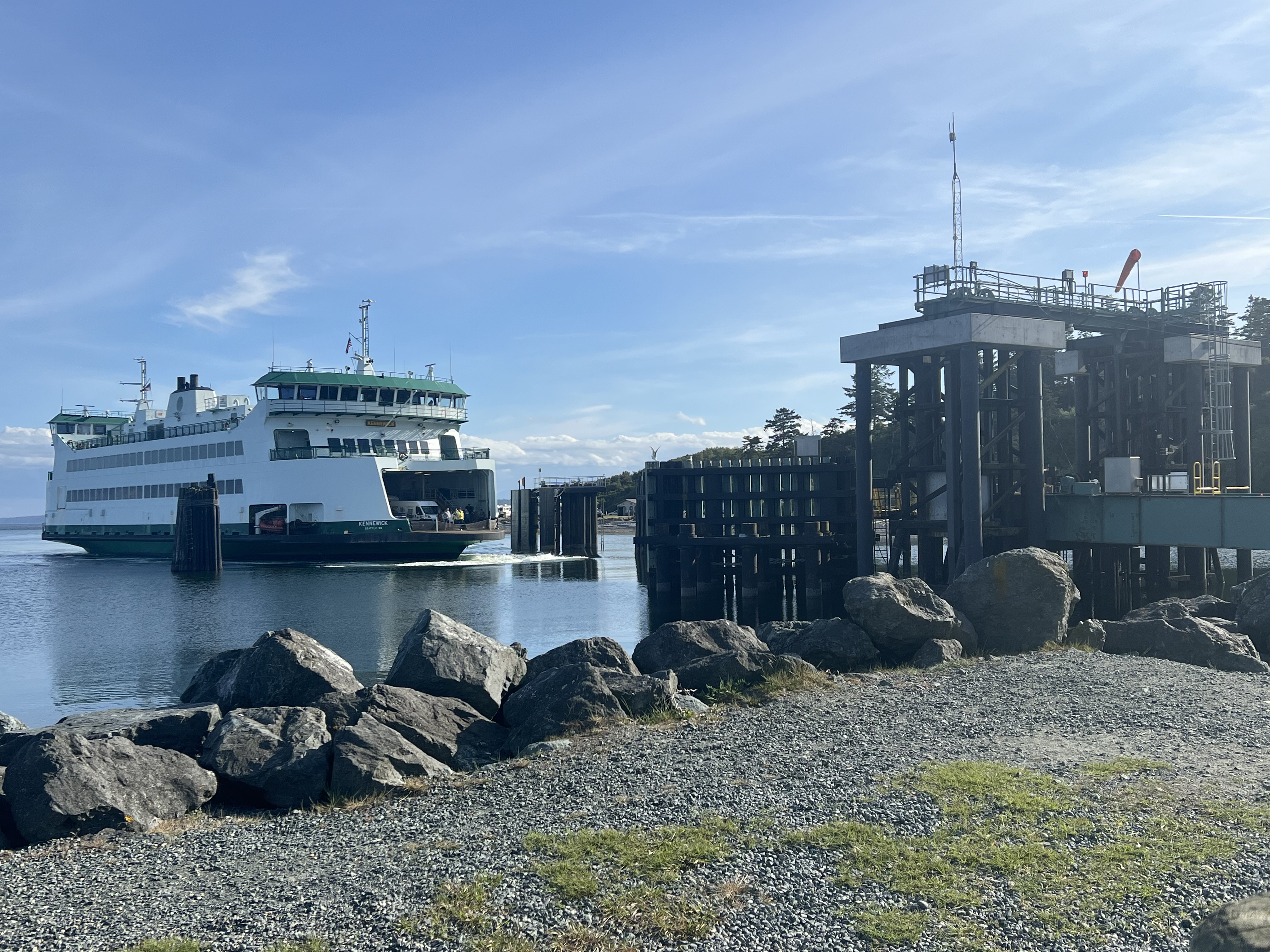
We’re finally airborne, headed north for Juneau, after the usual departure on a Jefferson Transit bus, the transfer in Poulsbo to a Kitsap bus to Bainbridge Island to board the Seattle Ferry to Coleman Dock and catch a taxi to SeaTac, where we wait in long lines and at a crowded gate.
The mood among the passengers is upbeat, celebratory. Their fine Norwegian sweaters are telling: many are bound for 17 May and festivities to mark Norway’s independence from Sweden. We change to a southbound flight for Petersburg where all but four passengers disembark into the welcoming embrace of the town known as Little Norway.
Jack and I walk down the street to the harbor to rejoin Aurora. We have missed her! Our twin purposes are to give our boat some TLC and ready her for summer adventuring while reveling in the annual Little Norway Festival.
Thursday 23 May Ruth Island, Thomas Bay 56º458.8’N 132º48.9’W
Shakedown cruise to nearby safe harbor on Frederick Sound at end of Festival and both prep and provisioning goes faster than anticipated owing to sunny weather. Folks with whom we had pizza in Petersburg’s almost only restaurant the night before, anchor nearby. Randy and Sandy tied up near us in Petersburg on their early season Inside Passage. Their S/V Dragonfly moors in the Duwamish River so they have great experience around huge ships in the Port of Seattle. AG and Jan and two guests on the Nauticat with a Finnish name tell us to go to the Le Conte Glacier They raved about guide Scott Roberg who can navigate the braided rivers in his fast little aluminum boat M/V Tongass Jem. Next time.
I undertake the serious work of organizing articles from Pacific Yachting, especially, and also from Cruising World. Every year I drag issues I don’t read onto the boat. Good rainy day reading on long passages before the mast. Now the stack is 10 inches high with select issues back to 2014. Impressive how many of the authors I’ve met, particularly through the Northwest Maritime Center.
Friday 24 May Cannery Cove, Pybus Bay 57º18’N 134º09’W
Drop anchor in front of the river which comes from a low lying lake fed by waterfalls all around the icy cirque. Another boat follows us in as we wind our way through rock and reef into a favorite Admiralty Island cove.
Later, the Captain of a large family yacht comes dinghies over to asks if we have a fishing license as his crab traps are filling up with males. We don’t; our brainpower is used up just getting where we want to go. I figure his inquiry is in the spirit of both honesty and generosity. Yes, it’s their first time here and in following us in he took a chance that we were “local knowledge.”
After readying the boat quickly thanks to good weather, we’re making a slower start to actually cruising. Quite a bit of organizing is still required below deck. Take a beautiful sunny day and get it done. Plus time on deck reading book on Vancouver’s Alaska expeditions in 1793 and 1794, which ended pleasantly and productively at Port Conclusion even as they ruled out finding the long elusive Northwest Passage.

Sunday 26 May Baranof Warm Springs 57º05’N 134º49.9’W
The docks were rebuilt a couple of years back and now there’s moorage to pay. $20 a night for vessels between 20 and 35 fee; $30 a day for vessels between 35 and 50 feet. No electricity. Delicious water, ceaselessly flowing down to the floats from an alpine lake.
Rafting two boats is fine (and really should be mandatory) but gone are the days when seiners rafted out from the float five or six abreast in one big party.
Among the other boats this time are Tanka, the Grand Banks of Loni and Jim, who winter in Port Townsend and summer in Warm Springs. Jim’s from Petersburg and we made their acquaintance at the Little Norway Festival. Of course they know our friends Pete and Kelsey, who loved wintering over as the village caretakers. The whale watch boat, whose place is saved by a smaller inflatable we were tempted to move to make space on the dock. Two very large boats; both seemed over the dock’s 65 foot limit. The luxury yacht Maximo is crewed by a friendly, long-married, (hard)-working class couple from Seattle. Just the two of them. When the small cruise ship Misty Fjords drops off its handful of guests on the float plane dock, Maximo invites them to raft, delighted to return a favor to Sitka’s Allen Marine. The next day there are three boatfuls of Alaska families – we marvel at their kids’ independence and small boat skills – rowing, kayaking, and stand up paddle boarding.
First order of business in Warm Springs is a bath. The community manages the lovely community bathhouse that looks out on Baranof’s high peaks. Later when a group heads up into the mountains to bathe in one of the hot pools above the village, I join them. I get carried away and when supper time comes I realize I have to walk down by myself along paths and the boardwalk shared with bears. I’m getting comfortable around whales but brown bears are another story. So I try what Alaskans do. I talk gently and without interruption let the bears know I’m making my way through their territory.
Hey, Bear, how are you doing? Did you have a good winter sleep? I hope so. I’m trying my best not to be afraid of you, but you know, your cousins down where I live are sometimes not very friendly. I hope that the fishing has been good for you so far this summer. I certainly hope you are finding enough to eat. Are you getting nice and fat again? It certainly is good to have the days getting longer, isn’t it, Bear. And everything is growing! Look how big the skunk cabbage is, Bear, how pretty the tall yellow blooms! So much bigger than I’ve seen other places. And have you been eating salmon berries? I picked a couple right from the board walk even though they were not quite ripe. Salmon berries are the best food in the world, aren’t they, Bear? I love all the colors they come in. And how they glow translucent when they are really ripe. But the best part is their long season. Isn’t it wonderful, Bear, how a single branch of can have blossoms and ripening berries and berries ready ripe to eat?
Tuesday 28 May Tenakee Springs
Whales spout all along in Chatham Strait. Sunny weather but no wind. As we pass a cell tower, we get a data dump. I’m learning to answer emails immediately on the phone in a few words.
We turn into Tenakee Inlet and tie up in the diminutive harbor of Tenakee Springs. At the top of the wharf, I drop a moorage check into the slot in the door of the harbor master’s hut: 50 cents a foot plus 2% tax.

This Chicagof Island village has not changed much since our last visit. Still seems to have the uncomfortable mix of loners and artists. A sign on a house states “No trespassing. Due to the cost of ammunition, no warning shots will be fired;” a sign on the one next door says “Peace House.” A “Trump in 2020” flag waves in the wind in concert with Buddhist prayer flags. The free shed is nicely organized but the coffee shop with a gallery and bakery is for sale. The Alaska state ferry calls less frequently but there are more regularly scheduled flights. The bathhouse is decorated with whimsical new murals but the rules are the same: men and women at separate times, nakedness required, and wash up Japanese style with a bucket and soap before submerging yourself in the pool.
As I’m preparing supper, there’s a knock on the hull. I pop up the companionway to be welcomed by Dave. He introduces himself as a liveaboard, on that ketch there. He points to it. I look, confused, finally making out the two masts. But they are junk rigged! It’s a flat bottomed Chinese junk! Without an engine! We invite Dave and his partner Anke to supper and hear all about their singular way of doing things and getting around. It turns out they winter over at Warm Springs, as caretakers along with Pete and Kelsey. I can’t imagine four better people with whom to spend the long cold dark winter.

Wed 29 May Hoonah 58º06.4’N 135º26.8’W
It’s been 9 years since we ferried in to meet Aurora after her wintering over in the small protected fishing port of this Native village. The fuel dock is not where we’d expected it, high up on which Hoonah Trading wharf. Back then, you took the hose the attendant dropped down to the float and sent your money or credit card up in a basket when you were done. Now it’s a proper fuel dock on a float tucked behind the ferry landing. The skipper of a fishing boat takes our lines, pointing out the docking hazard of metal pylons that extend beyond the (large, generous) wooden toe rails of the float. He’s not fueling up, just stopped to let his kids run up the ramp to get ice cream cones from a food truck. I telephone for the required attendant and the fellow who arrives from the you-can-find-anything-you-really-need hardware emporium recognizes us.
Hoonah has become a destination and people are excited about Icy Strait Point. ISP is a project of the Huna Totem Corporation to turn an unused cannery site into cruise ship welcome for local culture, history and adventure. All the food, retail, and guiding businesses are owned by local people.

Friday 31 May Inian Cove 58º15.6’N 136º19.6’W
Icy Strait. Afloat on calm seas in a light drizzle with good visibility, we can appreciate the life that throbs below the surface. Warm blooded mammals dive and reappear but are only part of the mix in this rich food web. A commotion off our port beam gets our attention. A squadron of seven seagulls are doing their best to drive a Stellar seal lion crazy. As he tries to eat the fish he’s just caught, they dive bomb the poor creature and try to steal the fish.
Saturday 1 June Elfin Cove 58º11.7’N 136º20.8’W
As soon as we tie up at the transient float and look back through the narrow entrance, the Brady Glacier lights up in a burst of afternoon sun. From several miles across Cross Sound, its broad expanse glows.
Intricate complex of ramps and wooden walkways tie together a maze of the floats in Elfin Cove’s twin bays. Partly on pylons, partly clinging to land, a half dozen fairly modest looking fishing lodges are being repaired, cleaned, and repaired with the help of just-arrived college kids from Utah and Colorado. A couple of float planeloads drop off an early season sport fishing party. Elfin Cove is still rugged but the sport fishing industry has replaced the original population of commercial fishermen.
I’m told that a phone signal is available at the fuel dock so I walk out to the end and make my way carefully down a precipitously steep ramp to the float. It’s low tide. As soon as plop onto the visitors’ bench in front of the fuel office, Dave greets me. I thank him for sharing the wifi and he says it would be pretty hard to run his business without communications. He’s from Sebastopol, retired from law enforcement, and lives with his wife – currently in Anchorage training to be the village summer post mistress – on a steel ketch in the inner harbor. He ended up here after delivering a similar boat (what kind) around the North Pacific Rim. Got knocked down in the middle of the night by williwaws in the Aleutians and barely survived. Continued on though the Gulf of Alaska and into the inside waters of Cross Sound and Ice Strait. Relaxing over his first beers in a month, he learned that the fuel dock was for sale and the community was desperate. Elfin Cove is the first fuel stop at the south end of the Fairweather fishing grounds. Its economy depends on regular supply of diesel for the commercial fleet and on gas for the small sports fishing boats.
Dave’s a font of information and once he picks up on my practical progressiveness, he’s on a roll, expounding on views often unwelcome in these parts. We trade cards; some day I’ll have the time, connectivity and bandwidth to read the M/V DavidEllis blog along with our own.

Sunday 2 June Pelican 57º57.4’N 136.7’W


We were simply not prepared for the spectacular setting of Pelican, much less the fine construction of its boardwalk streets and meeting Coleen who showed us around.
I’m still asking about the downsides of Hoonah’s Icy Strait Point project but not hearing much really. Even John here in Pelican gripes about “briefcase Indians” with a twinkle in his eye. While I’m working on deck he’s telling me about his recent canoe trip from Sitka with his brother and growing up in Sunnyside and how his father came for the gold mine and married his Tlingit mother. Sunnyside is tiny settlement that predates Pelican and lies a mile away by boat.
Monday 3 June Porcupine Cove, Islas Bay 57º49.7’N 136º21.3’W
An hour of unavoidable swells on the beam as we leave Lisianski Strait, weaving among visible and submerged rocks that offer no protection. We don’t have far to go. Drop anchor and are done for the rest of a cold rainy day.
Tuesday 4 June Double Cove, Takeena Inlet 57º35.9’N 136º
Up at the as usual but today everything is easy. We bring up the anchor and head out hoping for a northwest breeze so we can get the sails up. But the open ocean along the west coast of Chichagof Island is flat. I bundle up in my circa 2018 REI down jacket with its all around down hood, sit with my back to the mast and watch the whales. We motor, covering more territory than planned. So much for our west coast sail.
We turn east into the sprawling Portluck Harbor and meander at low tide though Surveyor and Ogden Passages. Nobody here but us.
Wednesday 5 June Sitka 57º33’N 135º21’W
We head outside again hoping for wind. There is none. Clouds drape across the toothed peaks of Chichagof and ias the day brightens, it breaks clear. Soon Mt. Edgecumbe appears, still wearing its lentil shaped nightcap. In time it too disappears from the flat topped extinct volcano. It’s tempting to keep right on going down the west coast of Kurzof to enter Sitka Bay via Kallinin Bay, but Salisbury Sound with its gentle swells and heartbreakingly beautiful trollers wins the day. We approach the capital of Russian America via Neva Strait and then Olga Strait. These narrow passages between Chichagof and Baranof Islands are where you look for brown bears and small black-tailed Sitka deer, either on the banks or swimming across. We see nothing.
Finally in the harbor, we head for the fuel dock. One section is reserved for regular customers who can swipe their cards and serve themselves, something I’d never seen at a fuel dock. We do it the traditional way: the attendant hands me the heavy nozzle and I fill the tank, listening carefully to hear the gurgling which tells me to stop before it overflows. Meanwhile. Jack calls the Harbormaster – where we are regular customers – and asks for a place at the float at the foot of the ramp like last year and several years before. Within minutes, we’re tied up.
We stop an onslaught of news, emails, podcasts, tweets, the Audible daily deal, and the like. Fortunately I tune into KCAW and learn that the first performance in the Sitka Summer Music Festival is at 6:30pm at the Mean Queen, a waterfront pub and club. We quickly shower and and take off down Kalinin Street in hopes of getting a seat at a free event in a small bar. Why is a string trio performing Beethoven in a dive? Because chamber music was traditionally popular and performed in small public venues.
The last tiny table is ours. We push it against others when we’re joined by a multi generational group of Sitkas. The pizza is delicious. The musicians arrive, instruments on their backs. Cellist and Artistic Director Zuill Bailey is back another year, musician friends in tow. The crowd is all local and all ears. Nobody misses a note.

Each week of the monthlong festival features different musicians and a coherent program. This week features Beethoven’s string trios. He wrote them early in life, when he was clearly full of himself: these exuberant compositions demand attention. But there’s also Richard Dowling, a pianist and scholar of Scott Joplin, whose works Jack was preforming until the bicycle crash that took away his hands. Dowling will give a formal concert on Friday. Thursday there’s a free concert on the Shelton Jackson campus, Saturday an evening a formal concert and Sunday afternoon a family performance (followed by root beer floats) in the ceremonial house of the Sitka Tlingit.
Perfect. We’ve told the Harbormaster we want to stay five days. That means five concerts, three of them free.
Monday 10 June 2019 Appleton Cove on Peril Strait
Farewell, Sitka. Goodbye Sara and Brian. Cruising to Halibut Point through Neva and Olga and across Salisbury Sound is wonderful. But Peril Strait is a pain. In naming it, Vancouver was accurate You have to take Serguis Narrows within 5 minutes of slack. And then there’s Deadman’s Reach. At the end of this trial, fortunately, the National Forest buoy at Appleton Cove is empty. Does anyone else know its existence?
Tuesday 11 June Takatz Bay 57º07.9’N 134º51.5’W
Choppy seas, low SOG (speed over ground) dropping to 2.5 and 3 knots. South winds chop up the ebb, we’d hoped would aid our southern progress. It’s foggy and we lose site of land.
Finally we turn into Takatz Bay, just to the north of Baranof Warm Springs. We wind out away among visible and invisible rocks toward the great peaks. There’s no large scale chart for this bay and Navionics and our Standard Horizon chart plotter are giving us contradictory information about where we are. As motor in dead slow, Standard Horizon thinks the boat is on land while Navionics squeezes us into one of the most beautiful coves we’ve ever visited. Dropped anchor in front of a waterfall and just left it there for two nights.

Thursday 13 June Kake 56º56.8’M 133º53.7’W
We headed out at 6am and turned right down Chatham, rounded (the often notorious) Point Gardener and left into Frederick Sound where we put up the sails and turn off the engine. In the peace and quiet we don’t need to watch for whales. We hear them as they exhale and turn our heads to watch them dive.


Friday 14 June Port Protection 56º19.4’N 133º36.7’W
With Kupreanof Island on the east and Kuiu on the west, we make our way into Rocky Pass so we can be at the Summit an hour before high slack. A seiner with a ready crew, net and skiff bide their time behind us and then pass when there’s enough water for them.
Jack’s an evangelist for this long narrow inside route which only became passable in a keel boat once it was dredged a decade or so ago. The Douglass cruising guide needlessly scares sailors off. The alternatives are the open ocean to the west or Wrangell Narrows. We’ve done Rocky Pass multiple times as Jack tells people, urging them to do it.
A couple of the aids to navigation need repair and there’s a red missing in Devil’s elbow. However, large scale charts 17402 and 17403 for the northern and southern portions of what is officially named Keku Strait are very good.
Port Protection, named by Vancouver, is adjacent to Point Baker where we overnighted last year. I want to stop there because I think we’ve never been, though Jack insists we have. We drop anchor right in the center of the village. It looks a bit familiar, similar to Point Baker and much like other Southeastern villages built around small coves to serve fishermen. Several houses, some on pylons, a public float, a fuel dock and store, a tidal grid for repairs. We’ll need to check the blog to see who is right.
I’m having second thoughts about Baggywrinkles’ Blog. It seems pretty stupid to have document experiences, chronicle lessons learned and record navigation tips in a place that is inaccessible. While cruising you need print. Sure, I’m coming round to trusting regularly updated digital charts. But there’s something about zooming in and out that throws me off my bearings. And digital charts do a lousy job of showing place names, the contours of the land, and the height of the peaks.
Illustrated online blogs don’t pdf well so I’ve been thinking about logging in a more accessible form. Especially now that we’re visiting charming, neglected Prince of Wales Island. POW is the third largest island in the US. Its offers gentle, accessible wilderness and hundreds of protective anchorages and gunkholes along an extensive shoreline. It’s home to less than three thousand souls, dispersed in a wild variety of Native and non-native settlements. While Prince of Wales lacks the spectacular high peaks of Baranof, it’s geologically more interesting with the largest cave in the US and fascinating karst formations in eroded limestone. Alaskans come here to fish and hunt, filling their personal quotas and their freezers for the winter. The bears are black, not brown, making time in the woods less fraught. Outsiders are rarer. The ferries of the Alaska Marine Highway don’t call here. When your ship sails in everyone knows you are there and welcomes you. It’s a place where people say hello and passing drivers wave.
Saturday 15 June El Capitan Pass 56º09.6’N 133º23.9’W
We drop anchor in an un-dredged portion of the Pass just beyond green aid to nav 5A. It’s still. Only three times do we feel the gentle wake of a small boat passing. When we pull up anchor, we see it’s good mud, though the shores are rock walls in this spot.
Well rested, we continue through Dry Pass. Previous times we’ve seen large rafts of sea otters wrapped in fronds of buoyant sea weed, where mothers and pups all faced us as we passed. And other years we’ve witnessed swimming lessons, where a Mom pushes the little one her stomach to solo swim between her feet as she backstrokes away. At the same time, the number of males out in open waters seems to be growing. From a distance they resemble ill-shaped logs, big feet at one end, big head at the other, as they lounge on their backs like warm Florida retirees. But as soon as they are aware we’re passing, they tread water vigorously, thrusting half their bodies above the surface for a better look at us and for us a better one of them. Completely endearing.
Sunday 16 June Yahku Cove just beyond Naukauti 55º47.8’N 133º13.5’W
The Douglasses describe this tiny cove as a real find, citing the lush old growth forest on all around. Still lovely and excellent protection but the hills above are being denuded by a large and active logging operation we encounter just out of Naukauti, five miles or so back.

Monday 17 June Craig
Throughout today’s passage we do not see another boat, nor a structure or a road until we stop at the Craig fuel dock. There we’re warmly greeted and competently served by a teenaged girl and boy. There are good summer jobs for kids in these parts.
Later on the dock I see Charlie, who fishes out of Craig in the summer on Mixie, his troller Hoquiam stern, before cruising back down the coast with his wife, Zee, to winter in Port Townsend. It was one busy winter, I say. Mixie looks good! I apologize for passing her on the hard in Boat Haven nearly every day on my bike errands and not stopping to say hi or leave a note. How good is to pull into the Craig fuel dock with those nice kids after all that wilderness. Charlie winks and reports in a whisper that fuel dock crew are astute at sussing out where the fishing is good. Just this week he shifted to long-lining and, with the help of his son, landed 12,000 pounds of halibut on Mixie! Not bad for an 82 year-old!
Craig is a sweet town whose residents absolutely love it. We’re grateful to find moorage with most of the fleet still in. Michelle at the Harbormasters Office does her best to squeeze in boats using a map of floats and unnumbered stalls. We ask to stay three nights, paying $0.68 a foot per night plus 5% tax. On Tuesday, Jack calls. Electricity would be nice, if possible. Michelle is working on it: she calls the owners of the boat that has just left, finds out they’re not coming back, informs the power company so the dock plug in is returned to the City of Craig Port account and says plug in.

Jack and I plunge into the comforts of POW’s largest town, about 1300 souls strong. For me it’s the library on the hill. My favorite on a long coast with a lot of competition. And, as I tell the Librarians, I love walking up the hill to it because Craig is surrounded by sea, like Port Townsend. Among the commotion of toddlers playing, teenagers being mentored, people getting help with computer problems, parents choosing activity bags with books and projects, I finally draft last year’s Christmas letter for Jack to proofread; 2018 was just too busy and, hey, the upcoming solstice is just six months off. I talk to Kyle, VP of the PHLUSH Board, who’s managing the revamp of the website and the relationship with designed, who has been carefully vetted in a long process. And I move Jack’s log, along with my rough notes and a few photos.
The laundry bag is full again so we spend the evening at the laundromat, but not before ordering pizza at one of Criag’s three eateries that serve supper, with pizza the only choice at two of them. I put the whole bag in one industrial strength machine while Jack waits for the pie. We share our supper with Lee and Kathy, who own the Laundromat and ran a fishing lodge nearby as their retirement business. Or rather, they created a fishing lodge, building cabins and floats and buying boats and getting their captains’ licenses and hiring seasonal staff. This is their first summer back in the five years since Lee suffered a massive stroke, coming out of a long coma to learn to speak and cope again.
We exchange travel stories, how wonderful the Alaska State ferry from Bellingham used to be, before the service cuts and fare rises. Now Kathy and Lee fly, shipping their car on the weekly barge from Seattle. We talk about how awful the airlines can be. POW’s airport at nearby Klawock is not served by Alaskan, as I’d thought, but by smaller planes with flimsy narrow boarding stairs Kathy reports that the local airlines was helpful the last time but explicitly said they couldn’t count on such service at peak season. Jack says that’s not right, you’ve got to stand up for what’s right. I agree: we’re all TABs (Temporarily Able-Bodied) until we aren’t. Let’s stay on message about this.
On our last evening in Craig, we go to the town’s non-pizza dinner place – the fishing lodge at the end of South Harbor on the road beyond the Harbor Master’s office. Date night. Good food. Strong sun setting. Spectacular view.
Thursday 20 June Hydaburg 55º12.6’N 132º49.7’W
Today we can’t get underway by 6am as is our habit because we have to transit Tlevak Narrows at slack tide. It’s “hurry up and wait,’ says Jack. For someone who is always early – getting up in the morning, arriving at events – this is hard on him. But not on me; I act most efficiently under the crush of time and am getting comfortable about being late. Selectively, of course.
So I enjoy the morning, remembering friends who sent Christmas greetings and news. I email a few solstice greetings with our 2018 annual letter, which should have gone on the winter solstice but did not exist until this week. Since we are hardly ever on Internet and will be much less so along the British Columbia coast, my intention is to get the letter duplicated, take my time writing personal notes, and mail them along the way. Alas, Craig’s only available color photocopy machine is down. (At Alaska Gifts, a shop that sells Native crafts.)
Before we cast off from Craig, I chat with a fisherman whose rig confounds me. On the stern hang three large coils, one of a red rubber hose about 2 inches in diameter and two with much smaller yellow hose to which an electrical cord is duct-taped at 10 intervals. “What’s your fishery?” I ask, pointing to the hoses. Scott says geoduck mostly but also sea cucumbers. The yellow hoses are air lines. They’re 400 feel long. I forget the name he uses, but in BC they’re hookahs, as in Arab water pipes with their long hoses. There’re for diving without the bother of scuba gear. The cord attached allows communication with the deckhand above. As for the red “fire hose” it’s attached to an air compressor. Scott beams, as he explains how to “dig” geoducks.
“At the end of the fire hose is a three-foot long piece of metal pipe. When you see a siphon sticking up from the sea floor you grab it and then drive the pipe into the sand next to the geoduck (pronounced gooeyduck). You hold on to the siphon for dear life so the compressed air doesn’t launch you back to the surface. When the for air hits the geoduck from below, it just lets go!”
“Wow. Amazing. So how deep do you go?”
“Usually not more than 60 feet. The reason the air hoses are so long is because sea cucumbers spread themselves out and you have to wander around to pick them up.”
I thank Scott for making me smarter, ask if I can take his picture and we’re off.

The passage south is as beautiful as the weather. We pass Waterfall, a sport fishing resort on the premises of a large former cannery. There’s a “No Visitors” sign on the floats, indicating that it’s strictly fly-in and probably not deep enough for our keel. We bide our time within view of the north end Tlavek Narrows, as four or five float planes roar overhead, delivering guests from Ketchikan.

We can see red buoy #4, which is famously towed clear under the water at maximum flow. Although you’d never guess it from the chart, this narrow passage between POW and Dall Island ebbs out to the north and floods to the south. Twenty-five minutes before dead slack we pass red buoys “4” and “6” emerging into wider waters completely filled with whirlpools. No problem because the flood has begun and pushes up along at 7.5 and 8 knots.
We motor through more narrow passages and islands that remind us of British Columbia’s Broughtons, see a few sea otters, a humpback and lots of eagles. The bull kelp must be growing at foot a day now, helping us assess depths and the directions of currents. Clumps of a brown seaweed that is unfamiliar to me floats here and there. As its broad spiraling fronds emerge high enough above the surface to hide a dirfting log, I pay it heed.
Three hours later, after flooding out of Tlavek, we enter the fine bays surrounding Hydaburg on with another good push of a flood. Go figure. With diurnal tides reaching a high or a low every six hours, it doesn’t make sense.

As we turn toward Hydaburg, the black coat of a bear glistens as he munches grass on a lush patch of green. Soon bright colors stand out on against the sunlit green spaces between the grey wooden smoke houses on the waterfront the largest Haida Native town in the United States. What a lovely sight! Families are relaxing in the remarkably warm afternoon sun of the summer solistice, the kids splashing with their colorful plastic floats and beach toys!
It’s 3pm by the time we arrive. Since moorage is paid at city hall – no registration envelopes or drop box on the wharf – I make my way there. At the top of the ramp I phone to Harbor Master to report our arrival on a 40-foot boat. “Okay,” he says,” I’ll call the girls in the office and let them know you’re coming.” And he reminds me where city hall is located.


The town has changed a bit since we were last here. The grass among the poles in the totem park in front of the school. A new craze of picket fences? The lushest kitchen garden I’ve ever seen prompts me to stop and take a picture. And on a rocky promontory above the water a beautiful new hand built shingled wooden long house is nearing completion.
I walk into the city hall early enough to get all the news. Yes, the long house is nearing completion. “The carving shed has moved down the hill. Right now they’re completing the poles for inside and outside. If you go tomorrow at 8am – the carving shed always opens on time – you can see them.”
City Clerk Jennifer and a friend fill me in on the rest, pointing to a large Google Earth map with every neighborhood and house identified. The new Haida language preschool is going well, even though only one local elder who learned this language as a child. In Canada’s Haida Gawaii, however, there are sixteen. Thanks to YouTube, educators trying to save the language from extinction have something to work with. They are busy preparing for Hydaburg’s famous Culture Camp the last week of July. Haida from all over gather, including a few Canadian cousins. There are intensive language classes, cedar bark preparation, hat weaving, mask carving, tanning and drum making, singing and dancing.
“Can anyone come?”
“Of course”
“Do you have jobs for volunteers?”
“You bet.”
“Wow. Sounds great!”
Since we see sea otters expanding their range every year, much to the distress of fishermen who reply on Natives to cull them, I ask if anyone has pelts. I learn that a party recently harvested a dozen sea otters and sent the skins to Anchorage for preparation.
“Will they be sold?”
“Oh, no. They’re for Culture Camp. Everybody gets what they need to decorate the hats, capes, masks, and jewelry they make.”
It’s closing time. They wish we’d stay for the Fourth of July and tell me about the many games and the donated prizes. After having watched the people of Petersburg catch herrings thrown a city block away and the people of Craig roll logs (standing on them – in the water!) I know how seriously Alaskans take these competitions.

Friday 21 June Nichols Bay 54º43.3’N 132.08.2’W
We head south through a magical morning and circuitous inland waterways before heading out into the open Pacific far beyond the rocky shoals. There, powerful following waves move us down to the coast.

We don’t see another boat until we near Nichols Bay. Entering is extremely difficult because of the white-capped tidal rips. The wind is raging in the southernmost anchorage recommended on our charts so we move deeper in. Eschewing an area where we once awakened to a huge uncharted rock that hemmed us in low tide, we drop anchor farther out and listen to the chain grown and rumble across the rocks as the wind swings us.
A storm is coming in. We’re out of range of NOAA weather reports now but Environment Canada has the story of the new system coming in. We opt to spend the weekend hunkered down. We read, cook, bake a cake, slaughter the still-green Caribbean pineapple and find it delicious, and finishing recording and organizing all our Canadian charts.
Monday 24 June Prince Rupert, British Columbia 54º19’N 130º19.2’W

Good bye Alaska. Early bird Jack rouses me at 3:20am, after making the coffee. It’s quite light out so we haul anchor and get the mainsail up right in the bay. The morning is lovely and the seas favorable. Nonetheless the crossing of West Dixon Entrance and the aways nerve-wracking transit of Venn Passage into the spectacular deep harbor of Prince Rupert.



Leave a Reply