
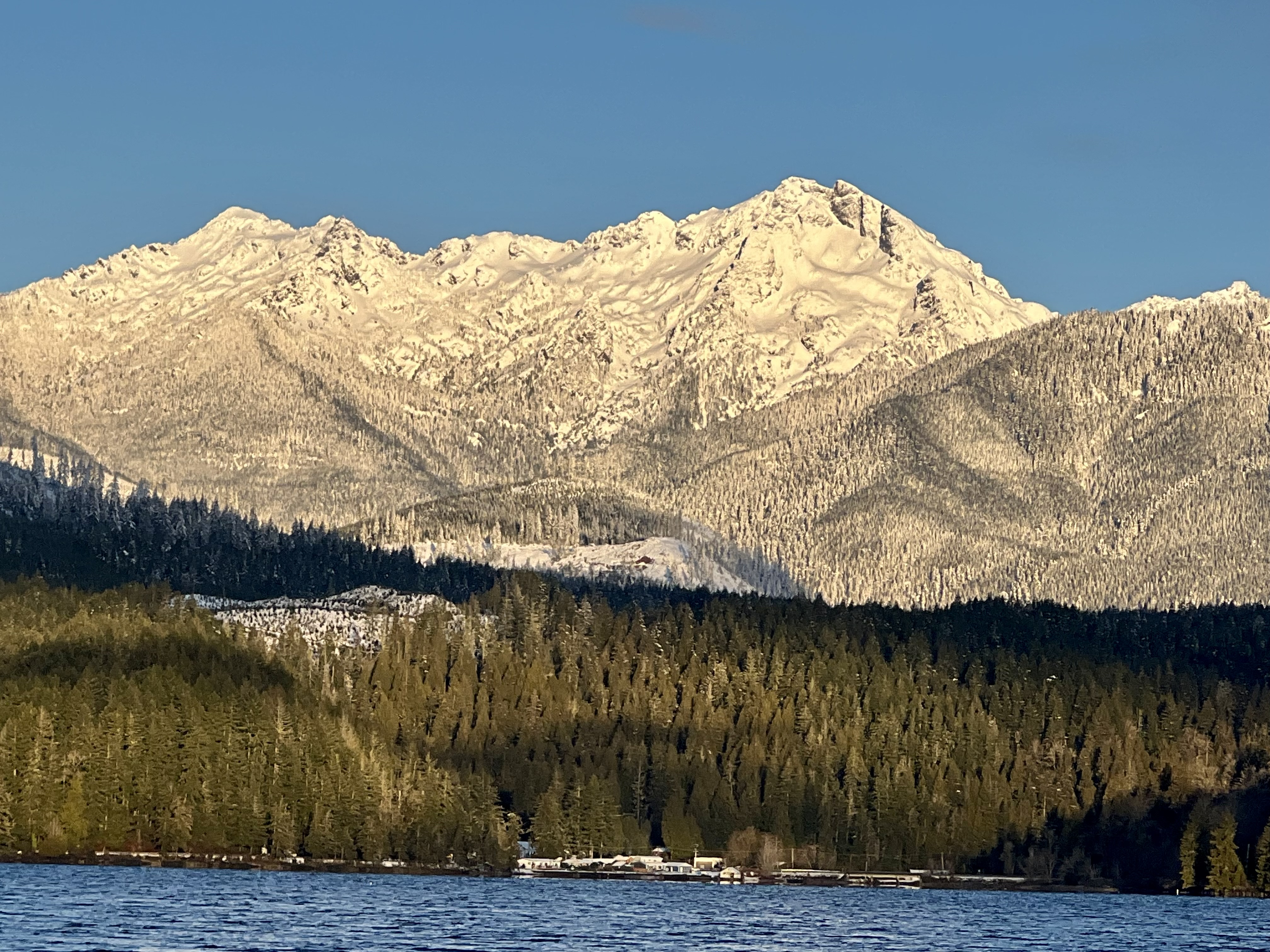
That tag line from hellobc.com fits the middle passage of our cruise. After entering Canada at Prince Rupert, we found ourselves along in a string of fabulous wilderness anchorages before rounding Cape Caution at about 51º North.
Monday 24 June Prince Rupert, British Columbia 54º19’N 130º19.2’W
Three nights at Cow Bay Marina is cruising in style. I’d emailed Manager Robin Beattie from Craig and reached him on the phone when three bars of AT&T appear on my phone during the crossing of West Dixon Entrance. Tired as we are after 14 hours of travel, we transit Venn Passage with a little as 6 feet under our keel. We pull in at 6:30pm Although we have 125 feet of water under our keel, we stay focussed. Learning that we can call Canadian Customs on arrival, we arrive before the marina staff leaves. Ready to help with our lines is Cow Bay’s Audrey and Mike, whose Sun Gypsy from Savary Island, share our finger. Prince Rupert is one of the places where assistance is dockside assistance is often needed thanks to the wild currents. These solid new floats – supported by metal pylons nearly 200 feet long in front of the historic Atlin terminal – are as comfortable as can be expected. Prince Rupert is one of the deepest deep water harbors in the world.
When Jack phones Customs to check in, it’s the usual. litany:
Do you have any of the following to declare? Guns? Pepper spray? Bear spray? Cash, Liquor?
“No,. No. Yes. No. Yes.”
But there’s something new on the list: Cannabis? Yes. The folks on the other end of the line – in Ottawa – tell us to stay on the boat; someone will be down to see us within the hour.
Although available in Canada and legal at the federal level, Jack’s medical supply purchased in Alaska is confiscated by two impeccably pleasant officers. They join us in the salon, weigh bud, pipe residues, and bag them along with an oil cartridge, and give us receipt. Okay. We’re happy to support the local economy. Where’s the weed shop? Reluctantly the officers deliver the news: Rupert doesn’t yet have one.
We wake to fog horns each morning – even the bulk freighter anchored out in the bay is blowing horns in all directions. Then the sun burns off the fog leaving beautiful days. I even put up the bimini and spend a day in the warm shade on deck posting on the blog. I love watching the harbor traffic. A mighty little tug boat is towing an enormous barge with its ramp pulled up, suddenly circles and snuggles its bow to the bow of the barge. The pilot hops out and refastens his load in the new configuration and within five minutes is pushing the barge toward the mouth of the Skeena River. I never fail to marvel at the vessel handling skills of tug boat captains, who often work alone.
What a pleasant town! One day there’s a modest-sized cruise ship at the new dock which has stood mostly empty for years. I inquire and find that throughout summer this year there will be 29 such visits. Seems just about right. So much better than Ketchikan, which gets up to five huge ships a day. Rupert offers fishing, outdoor adventuring, and excursions to the remarkably preserved North Pacific Cannery. The Museum of Northern British Columbia is second only to Victoria’s Museum of British Columbia. Add the wonderful museum bookstore, Cowpuccino’s, The Breakers Pub, thrift stores where you can find anything, and the last marine services for hundreds of miles: Rupert Rocks.

Thursday 27 June Kumealon Inlet 53º52’N 129º58.3’W
We’re ready to be back in pure wilderness. Fog makes for a late start and the wind again fails to blow away either the fog or the boat. We motor along, straining our eyes despite their inability to focus until the fog breaks and the colors return. Six hours later we’re snugged into a one boat cove off Kumealon. I set myself to working through my new books on the social and material culture of the North. Two from Alaska immerse me in Eskimo village of the first half of the 20th century while a third is on foraging, fishing, hunting and food preparation in Haida Gawaii.

Friday 28 June – Lowe Inlet 53º33.4’N 129º34 W
We’re in the middle of long skinny Grenville Inlet. How is it we never noticed the lack of tide tables for the anchorages along the channel? Can no one figure them out? The Aye Tides graph for the northern end of main channel shows tiny floods and much larger, mishapen ebbs. How is that? By all accounts and experience, it’s hard to anchor in Lowe but somehow we hit the sweet spot. We drop in 20 feet over a tiny v-shaped extension of the shoal.
Saturday 29 June – Khutze Inlet 53º05.3’N 128º30.8’W
We finish Grenville Channel, enter Wright Sound hoping for wind, like the wild times we’ve roared though here. There is nothing. So much the better for the two young men we encounter in a traditional canoe, typical of an East Coast lake. They are headed into Grenville and should be okay. But where will they sleep and eat? Along the main channel where brown bears have no interaction with human might be better here than in the inlets, where they likely have.
Again we hit the sweet spot with the anchor on Green Spit, again dropping at about 20 feet. Which is necessary because we’ve got a spring tide. We swing down to 11 feet about 6 pm and call it high low. That means high low will come at 6am, before which we’ll easily get out. I get up for drink of water at 2am and see we’re up at 37 feet, with high high behind us. The night is calm and it looks like 2:1 scope has held just fine.

Sunday 30 June Clothes Bay just south of Klemtu 52º34.3N 128º30.8 N
Graham Reach is many shades of blue in the morning light. We motor along for hours without seeing another boat. I spend the day sitting on the spinnaker box leaning on the mast and reading.

When we approach Klemtu, we see a fairly large cruise ship stopped right in the middle of the channel just south of the ferry terminal. My mind tells me that there has been a medical emergency and someone is leaving ship. Remembering a medical transfer we’d witnessed in Glacier Bay, I said to Jack, “We should see a heliocopter land in a little while,”
I’d wanted to stop by to see Shane Robinson but the timing isn’t right and since it’s Sunday and the fuel dock and grocery are closed anyway. As we move on past the light house station, the Canadian Coast Guard folks keeping an eye on things wave to us. Then we see kayaks and inflatables as well as an additional orange topped survival boat lightering folks onto the beach in front of the big house. I’ve read the situation all wrong: Klemtu is actually hosting this cruise ship!
After we drop anchor and I’m on deck putting the sail covers back on after yet another windless day, I wave to a ship guy in an inflatable following a couple of kayaks who comes over to chat. He’s young, from Redmond. He says larger ships are changing format so people can get out on the water and now there’s more demand for licensed captains. The Nassau-registered ship has only 400 passengers and 200 have been delivered to shore. What with the Spirit Lodge, the big house, the beautiful little islands, and traditional young people like Shane Robinson, Klemtu can manage 200 visitors. They don’t need a museum, gallery, gift shop or restaurant and the counter in the grocery store that offers coffee and hamburgers can remain closed on Sunday. Here’s yet another First Nations community with a new generation bridge between their elders and the rest of the world.
Monday 1 July Bella Bella – Shearwater 52º08.8’N 128º05.2’W
We’re out on Matheson Channel when Canada Day dawns spectacularly. Rather than cross Milbanke Sound where there are swells but no wind, we take an inside route via Oscar Passage, motoring hours before we enter Seaforth Channel and see another boat.
We’re met at the Shearwater dock by Kevin, who answers to the name Christophe on the radio but who has replaced long time Harbor Master Christophe. It seems that Christophe and partner Cameo are living on their boat in Butedale, one of BC’s old cannery complexes that is falling into the sea. There’s a story here but we don’t uncover it. One shop owner mentions that he never figured out why the pair had moved on.
Wednesday 3 July – Humachitt Island on Fisher Channel 51º55.9’N 127º53.8’W
To us it’s Hot Shit Cove, one perfect little anchorage with view out on Fisher Channel. Every perfect little anchorage has a sweet spot and this one’s is take by a commercial crab pot. We drop anchor in 25 feet a couple of boat lengths beyond it. Summer has finally arrived and it’s warm enough to have not only drinks but a long late supper out on deck. The Northern Expedition, BC’s great ferry of the North, passes out in the channel but we see no other boats.
The next morning, we step into the cockpit at 5:30am to find the crab trap float and number buoy gone! We’ve slept right through whoever came to take away what must have be an empty trap.
Thursday 4 July – Fury Cove 51º29.2’ N 127º45.5’W
Fury Cove is exquisite. We remember our most magical night there. See the story For Midori.
Friday 5 July – Blunden Harbour 50º54.3’N 127º17.2’W
Back in safe harbor after rounding Cape Caution. The last four hours were completely adrenaline fueled. Exhausted.
This from Jack’s log: Calm seas before Cape Caution. Fog patches at Cape Caution thru Richards Passage. Several close CPAs w/ tugs in narrow shipping lane.AIS and VTS 71 worked well. Lesson learned from General Jackson.

Leave a Reply